We come to the end of 2021. I look forward with hope to the new year. Off we go, like these geese, high in the sky over Samish, Washington.


We happened to be in Anacortes, Washington recently. At my brother-in-law’s suggestion, we decided to sample the best of the local seafood. This, of course, meant a trip up to Samish to Taylor Shellfish Farms on Samish Bay. It’s about a 30 minute drive from Anacortes to the turnoff on Chuckanut Drive to go down by the bay to their shellfish store and eatery.

The oyster beds are out in Samish Bay.

This panorama shows the whole view from Edison and Samish Island on the left, the San Juans in the center, and Lummi Island on the right. Click on the picture to open a full-sized version.

This is the third and final post of my experience and pictures with a nice winter storm in the first week of March this year. The day before the storm was March 4th, the storm was March 5th, and it had cleared out by March 6th. It was a wild, windy, and snowy night while the storm came through.
I was glad that took precautions with my windshield wipers so they didn’t get frozen to windshield. I had rented the car from Hertz in Chicago and they had it stocked with an ice scraper/ brush. Those of you from places that don’t have snow, this link will show you what an such an instrument looks like. As a side note, my last minute flight arrangements would have taken me two days longer and cost $1,500 more if I had flown directly to Marquette from Los Angeles.

After completing my errands for the day, I set out to the places I’d visited before and during the storm. The Sun was beautiful coming through the trees at the Noquemanon North Trails Trailhead on the Big Bay Road (County Road 550).

The pines were covered in snow with icicles dangling down.

It was then over to Presque Isle Park and the Upper Harbor break wall. I was unable to photograph this during the storm because it was, well, too stormy. The waves crashing against the ice-covered break wall were beautiful.

This is the second of three installments with pictures from a major winter storm in Marquette in the first week of March, 2020. My prior post’s pictures were taken the day before the storm arrived. The next day, March 5th, it started snowing in late morning and by mid-afternoon was coming down very hard. Of course this was the day I was having my Mother’s belongings moved out of her apartment at Mill Creek. That’s Murphy’s Law for you.
After completing the move, I drove out to Noquemanon North Trails Trailhead on the Big Bay Road (County Road 550). It was about 5pm and the snow was coming down very hard. I’ve tried to capture it but it is really something you need to see in person. Click on any picture to get a full sized version.

The snow was coming down in big flakes and accumulating quickly.

The trees were getting quickly covered in snow.

This isn’t about the pandemic, although it was well under way when I took my trip to Marquette in early March. It is the first of three planned posts about my time in Marquette, specifically sites around the city before, during, and after a blizzard that came through on March 5th of this year. Click on any picture to bring up a full-sized version.
I’ll begin with a shot of the iconic Marquette Coast Guard lighthouse. Build in 1866 and still active today, it is a symbol of Marquette.

I was down at McCarty’s Cove which, in more clement weather, is a popular swimming and beach spot. Not too good for swimming when covered in ice.

Two birds flew by the waxing crescent Moon.

I took a trip to Upper Michigan at the beginning of March and, with the assistance and company of my high school friend Jim, we visited my late parents’ rural home at Conway Lake. Conway Lake is about eight miles from Big Bay, Michigan, and about 35 miles northwest of Marquette, Michigan. The house has always been knows as Camp. For me, this is a proper noun as it is the proper name of a place.
Camp is located on property acquired by my stepfather’s father in the late 1920s (or early 1930s, I am not sure). The land had been recently clear cut so what exists today is a well-kept second-growth maple forest. The land is surrounded by the Huron Mountain Club, an exclusive club formed in the 1890s and that included members like Henry Ford. This makes it even more remote than it already is.
Jim and I headed off in mid-afternoon from Marquette, heading up County Road 550 to Big Bay. Jim lent me a pair of modern-style snowshoes which are really amazing — lightweight and easy to walk in. When we got up to the Conway Lake east road, we were very pleased to see that it had been plowed. From the Huron Mountain Club Road to Camp is about 1.5 miles. That would be hard even in modern snowshoes. It turned out that my parents’ neighbors had plowed the road all the way to their camp so we were able to park the car not far from the driveway to Camp.
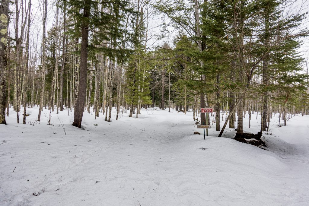
One image processing note: The dehaze function in Lightroom does a great job eliminating the complete washout of snow, allowing you to see the needles and sticks in the snow.
The walking in the snow was not easy. I am not sure we would have made it to Camp where it not for the fortunate plowing that had been done. We walked the couple of hundred yards to Camp and found it in good shape.
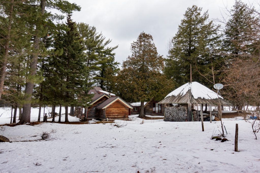
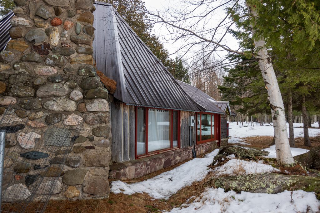
Camp was built bit by bit starting as a one-room hunting camp that my stepfather built after he returned from WWII in the 1940s. The original room is now the kitchen. One of the best decisions he made was to put on a metal roof which will last through many winters and at the steep pitch, sloughs off the snow.
After a brief inspection of the buildings, we headed out onto the lake to look around. In early March, I would expect the ice to be about two to three feet thick. We weren’t going to fall through. We noted someone on a snowmobile tending his tip-ups for ice fishing. A tip-up is a device that lets you put a line into a hole in the ice and raises a flag when a fish takes the bait. No sitting over a hole, just be warm and use your binoculars or a quick snowmobile ride to see if you’ve had a strike. Here is a panorama looking southwest from Camp. Click on the picture for a full-sized version.

For Thanksgiving last year, we traveled to Marquette, Michigan to see my Mother and family friends. From Tuesday though Thanksgiving in the last week of November, a good-sized November storm came through. I had a chance to take some pictures, and that is the subject of this post.
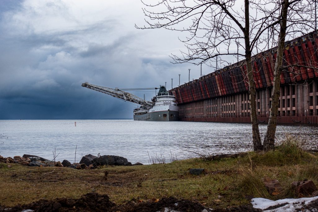
On the Tuesday before Thanksgiving, as the storm was gathering, I bundled up and headed out toward Presque Isle, a wonderful part at the northwest end of Marquette. Just outside the entrance to the park, I stopped by the Lake Superior & Ishpeming Railroad (LS&I) ore dock, the remaining operational ore loading facility in Marquette. As I arrived, I spotted a ship heading out on to Lake Superior beneath an ominous sky.
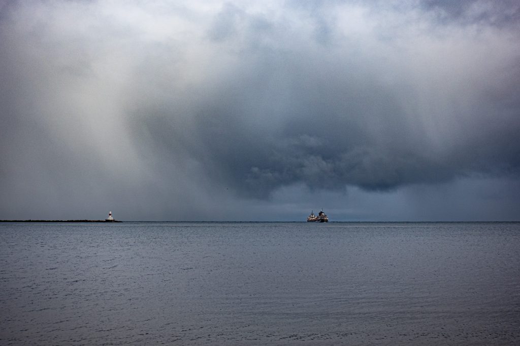
The ore dock, built in 1912, is 1,250 feet long, 60 feet wide, and the top is 75 feet above the water. It has 200 pockets for ore pellets, 100 on each side each with a capacity of 250 tons. Believe it or not, it sits on 10,000 wooden pilings. The ore boat Saginaw was tied up at the dock and loading ore.
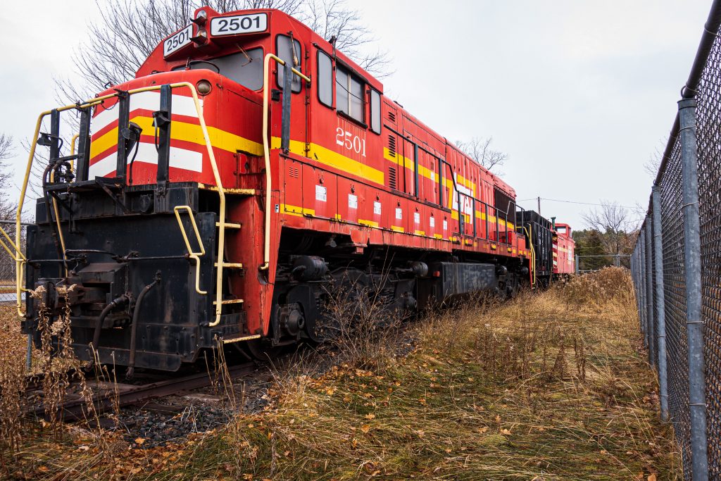
The LS&I have a retired locomotive parked by the dock. It is impressive.
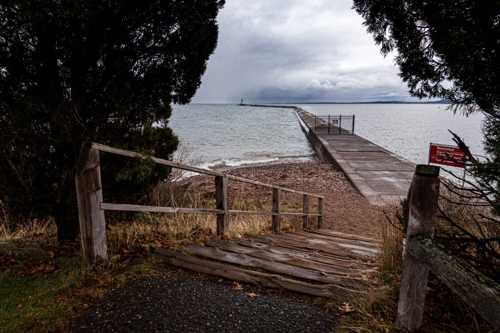
From there I went into the park and stopped to check out the break wall. Note the gate closing it off. It is a nice walk in the summer, but one needs to stay off in the fall and winter. In spite of the ominous skies, the lake was relatively calm.
We pick up our story as we arrive in beautiful Anacortes, Washington. 90 miles north of Seattle, Anacortes is the gateway to the San Juan Islands, a beautiful chain of islands connected by the excellent Washington State Ferry System. We were here for family reunion on my wife’s side. This post will cover very little from Anacortes, as that was all family activity, but much more on our drive south through the redwoods and down the California coast. But first, Anacortes.
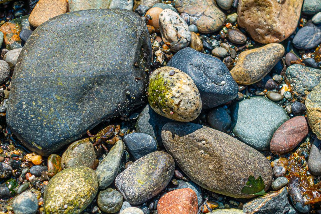
If you visit Anacortes, you must visit Washington Park. Located at the far west end of the city, next to the ferry terminal, this large park has many hiking trails and accesses to the sound (I suppose it’s the sound and not the ocean, correct me if I am wrong). I went there with my daughters on a nice sunny day and came upon this small crab. He (it?) is in the lower left side of the picture. Remember that you can click on any picture to see a full-sized version.
For those of you reading from the blog home page, from here I will drop to “read more.” Click through to see a kayak trip, The redwoods, Point Reyes, and Monterey. Here is a teaser picture. If you are reading from a direct link, like from Facebook, then you can disregard this message.
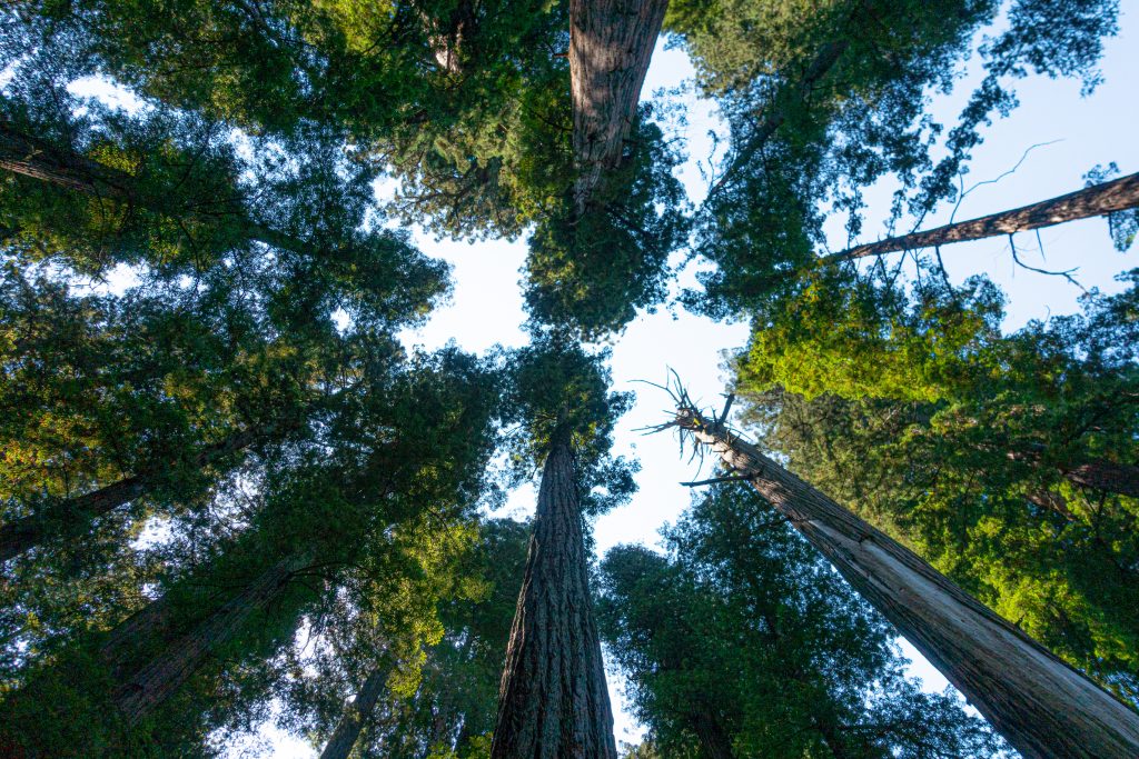
With a major family reunion planned for my mother-in-law’s 90th birthday, we decided to take two weeks and drive two and from Anacortes, Washington. Our route took us inland on the way north and closer to and along the coast on the way south. This post will mostly be a travelogue and, following my normal practice, I don’t include too many pictures of people. This is my third road trip post, the first being our trip to Anacortes in 2011, the second being an extended return trip from Anacortes in 2017.
We left on a Sunday morning, getting on the road around 8:30am. We went north through the San Fernando Valley, then merged on to the Antelope Valley Freeway, CA-14 in Sylmar. From there passed through Palmdale and Landcaster, stopping for gas in Mojave. This was a day for distance. After passing through the beautiful Red Rock Canyon State Park, we merged with US-395 where CA-14 ends just outside of Inyokern. Lunch was in Bishop, where my wife took over driving. When we passed through Independence, it was too early to have lunch at the Still Life Cafe, a remarkable French restaurant in this small town (population 660).
The terrain, which had started off with the coastal mountains, moved to the Mojave Desert and the arid and spectacular eastern Sierra Owens Valley, began to switch to pine and meadows. Mono Lake is beautiful I finally took a picture just outside of Bridgeport, California, 360 miles after departing Los Angeles.

You climb out of this valley, into a pine forest before turning northward towards Nevada. After you turn north, the highway follows the West Walker River. It flows down into another Antelope Valley, by the small town of Walker, feeding Topaz Lake and ultimately Walker Lake in Nevada. There was still plenty of water in the river from our generous snow-pack this year.

We stopped at the Shingle Mill Flat picnic area to stretch our legs and see the river.

It was then just a few more miles to Topaz Lake and the Best Western Topaz Lake Inn. With the conclusion of our first day, I will drop in the “continue reading” break and hope that you look at the pictures ahead from Crater Lake and Hood River. More to come next month in part 2.
Continue readingA week back, I took a short business trip to Chicago for a conference. This was my first visit to Chicago in over 10 years. I’ve been in and out of O’Hare Airport countless times, and it was weird to actually leave the airport to go to the city.
One of the highlights of the conference was an event at 360 Chicago. This venue is near the top (94th of 100 stories) of the John Hancock building and provides views in every direction (hence, 360 Chicago). The observation room is 1,000 feet (305 meters) above the ground.
The views are fantastic. Here is a panorama of the view looking southwest over downtown Chicago. The Willis Tower (formerly known as the Sears Tower) is on the far right of the picture and was the tallest building in the world from 1973 to 1998. It is now 16th tallest in the world and second-tallest in the United States.
The view north is also quite nice. Mid-April is a little early for beach activity in Chicago, but I would imagine the beaches below will be quite crowded in August. It had snowed just a week earlier even though the temperature was in the mid-50s Fahrenheit (~12° Celsius) during my trip.
360 Chicago has a thrill ride called “Tilt.” Tilt is a hydraulically driven set of glass stalls that tip you out over the edge of the building so you can look down. And I mean straight down. I admit that I chickened out and jumped back when it got way out, but did get this picture before I stepped back. As you can see, you are looking straight down.
One of the highlights of the event was an interview with Arnold Donald, the CEO of Carnival Corporation. Carnival is the largest cruise company and “has a combined fleet of over 100 vessels across 10 cruise line brands.” [Wikipedia] While he was providing great insights, there was a beautiful sunset right behind him.
I was staying right next door to the Hancock Building at the Four Seasons Hotel. Located in the 900 North Michigan Avenue building, the hotel is sandwiched in between a mall and condominiums. Here is a view of the 900 North Michigan Avenue building from 360 Chicago.
The hotel was very nice as one would expect from the Four Seasons brand. I was very impressed with their service, with one incident really showing their ability to deliver. The power outlets near the desk area had been damaged so that plugs would not make contact. I reported the problem to the front desk when I came down to dinner on Sunday night. By the time I returned to my room after dinner, it had been fixed. On a Sunday. I was impressed.
Apparently, the famous winds of Chicago can make rooms uncomfortably noisy. The hotel left these earplugs with this explanatory note next to my bed each night. Very thoughtful.
You must be logged in to post a comment.